Fees and access
There is no general admission fee to walk the avenue and its public spaces. Beaches, events or temporary services may operate under their own rules and schedules.

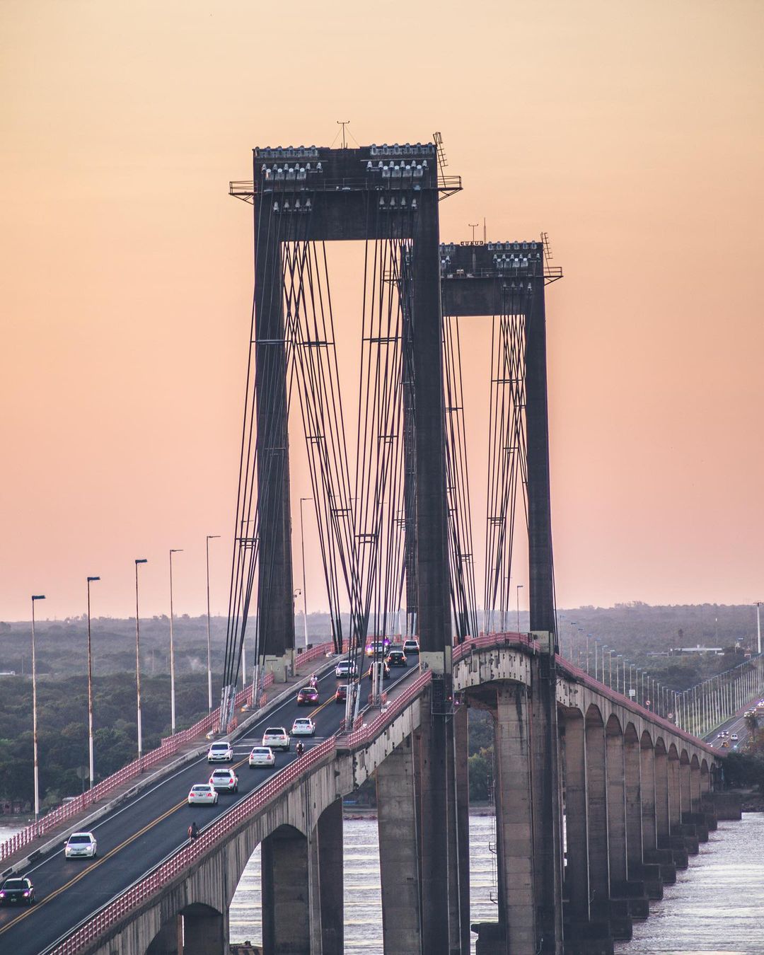
An urban riverfront promenade shaped by lookouts, green spaces, beaches and a daily rhythm that shifts with the river light.
Conditions along the Paraná riverbank and practical suggestions to plan your visit.
Loading forecast…
Loading forecast…
Loading forecast…
On the banks of the Paraná River, Costanera General San Martín connects an open horizon with plazas, recreation areas and places to pause. It is one of the most representative public spaces in Corrientes Capital and a regular meeting point for residents and visitors.
Costanera Norte was developed between 1929 and 1954 and extends for about 2.5 kilometres. Along its walkable waterfront are recognisable points such as Punta San Sebastián, Punta Tacuara and Parque Cambá Cuá, as well as views towards General Belgrano Bridge.
This is not an enclosed venue or a packaged excursion: it is a living urban edge, best experienced by noticing the river, the weather and the local pace.
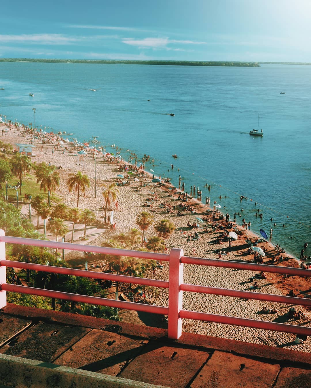
This is an outdoor public promenade. The experience changes with the time of day, temperature, river level and events; check official channels for specific beach or activity information.
There is no general admission fee to walk the avenue and its public spaces. Beaches, events or temporary services may operate under their own rules and schedules.
Late afternoon pairs a walk and river views with less direct sun. For walking or cycling, avoid peak heat and bring water.
There are urban stopping and parking areas on nearby streets. Follow current signs, access rules and restrictions; do not obstruct pavements, cycle routes or entrances.
The stretch associated with Avenida General San Martín was consolidated across these decades as an urban riverbank project.
The city added approximately 900 additional metres of waterfront, expanding its recreational continuity along the river.
The wider waterfront connects promenades, beaches, green areas, monuments, panoramic points and everyday social life.
General guidance based on the average climate of the Paraná basin in Corrientes (30-year normals). Figures are indicative; confirm current conditions with official sources before travelling.
| Season | Typical temperature | Rain | River & shore | Best for | Tip |
|---|---|---|---|---|---|
| Summer (Dec–Feb) | 25–34 °C | Frequent, late-day storms | High river, humid | Sunset strolls, hydration | Enjoy the breeze, avoid midday; bring water and sunscreen. |
| Autumn (Mar–May) | 18–28 °C | Moderate, mild days | Stable level, good light | Long walks, photography | The most comfortable season for an unhurried visit. |
| Winter (Jun–Aug) | 10–22 °C | Low, occasional light frosts | Lower river, sunny days | Thermal comfort, cycling | Cool mornings and nights: bring a layer. |
| Spring (Sep–Nov) | 18–30 °C | Variable, wind and rain | Rises slowly, migratory birds | Birdwatching, nature | Changeable weather: prepare for sun and rain on the same day. |
Choose an access near Avenida Costanera General San Martín and take a few minutes to orient yourself: wind, light and pedestrian flow set the pace.
Walk at your own speed. The value of the route lies in shifting perspectives: trees, steps, rest points and the Paraná horizon.
Parque Cambá Cuá and nearby spaces transition between the waterfront and the city fabric. Respect facilities, play areas and other people’s quiet time.
Low light makes the river’s breadth and the bridge silhouette stand out. After dark, choose illuminated and well-used sections.
Three routes designed by group type, plus a generic half-day and full-day plan. All start on the riverbank and adapt to the weather and local pace.
Start near an access with facilities, walk short shaded stretches, pause in plazas and green spaces, and head back before midday. Prioritise rest, hydration and restrooms.
Arrive early or at sunset for the light on the General Belgrano Bridge; explore Punta San Sebastián and the lookouts; bring a telephoto lens for birdlife.
Choose the flattest paved stretch, close to parking and benches; avoid slopes and riverbank descents; sit back and watch the landscape at ease.
Make the most of soft light and lower temperatures for a relaxed walk.
The lookouts gather the best views of the river and the bridge.
Finish before midday to avoid the strongest heat.
Combine the riverfront walk with the adjoining green area in one outing.
Nearby streets offer options to recharge and shelter from the sun.
Low light opens up the river and highlights the bridge silhouette.
Availability varies by stretch, season, works, weather and events. This guide notes service categories commonly found in the urban surroundings without promoting particular businesses.
Doctor Fernando Piragine Niveyro International Airport is outside the city centre. The municipality announced a dedicated airport–port bus in 2022; because services can change, check current transport before travelling. Taxi, remis or a pre-booked transfer are common alternatives.
Stops and routes change with local operations. Consult municipal channels or the local operator to identify the route and stop best suited to your chosen access point.
From the centre, the Costanera is reachable depending on the section you choose. Arrange drop-off at a clear landmark, use a helmet when cycling and cross only at marked locations.
The riverfront sits a few kilometres from the downtown core. You can reach it by taxi or remis, or walk or cycle down the streets that lead to the river, always choosing a signed access point with an easy way back.
Planning note: check current public city sources for timetables, fares and diversions. The municipal airport-service notice documents a historical route and does not guarantee present operation. Read the municipal notice.
The reference point is at Av. Costanera General San Martín 3400. Use the map to orient yourself and select access around the time of day, transport mode and conditions on the promenade.
Costanera Corrientes
Av. Costanera Gral. San Martín 3400
W3400 Corrientes, Argentina
+54 379 447-4702
A green public space within the Costanera setting, suited to adding a tree-lined pause to an urban walk.
An emblematic piece of infrastructure visible from multiple riverbank points and central to views over the river.
Punta San Sebastián, Punta Tacuara and other riverbank points reveal changing aspects of the waterfront.
The Costanera connects to urban corridors with varied food-service formats. To keep this guide independent, we do not feature particular businesses; choose based on hours, accessibility, dietary needs and waste practices.
A look at the Paraná basin and how to care for this public space. General information based on basin knowledge and local observations; confirm current regulations with the municipality.
The Paraná is among the longest rivers in South America. Its flow and colour shift with rainfall in the upper basin; the waterfront is just one strip of that living system.
Herons, cormorants, capybaras and migratory birds use the shore. Do not feed or chase animals; respect plants and resting areas.
There is no permanently open beach. If a beach is opened, follow signage and municipal guidance; do not drink the river water.
The sun over the river is strong. Use sunscreen, a hat and water; during storms or rises, step back from the edge and follow directions.
Take your rubbish with you. Respect other visitors and emergency access; the space belongs to everyone.
Weather, river level and services change. Check official sources for a safe, responsible visit.
Costanera Corrientes is located at Av. Costanera Gral. San Martín 3400, along the Paraná River, in the city of Corrientes, Corrientes Province, Argentina.
The general promenade is public space and has no general admission fee. Activities, open beaches or events may set specific conditions.
Allowing between one and a half and three hours lets you walk, pause, observe the river and connect with nearby spaces. Actual time depends on the stretch, weather and mobility.
Sunset is popular for light on the Paraná and typically gentler temperatures. A morning visit can also be a quieter choice.
There are urban parking options nearby, subject to signs. Restrooms and other facilities should not be assumed across every stretch; verify on site.
The municipality reported a dedicated service in 2022, but routes may change or be discontinued. Confirm the current position before planning and consider taxi, remis or a pre-booked transfer.
The stretch known as Costanera Norte, along Avenida Costanera General San Martín, runs for about 2.5 km. In 2008 the Juan Pablo II extension added roughly 900 m, so the continuous riverside front you can walk is close to 3.4 km. Beaches, access points and paths vary by section.
The reference point is Av. Costanera Gral. San Martín 3400, on the bank of the Paraná River. It is a few kilometres from the city centre and reachable by taxi, remis or bicycle; from the airport and bus terminal, taxi, remis or a pre-booked transfer are the usual options. Check current city bus lines with municipal sources before travelling.
This guide cross-checks attraction information against public sources and recommends confirming operational changes before travelling.